
Impact of High-Resolution Terrain Data in Tropical Cyclone’s Simulations
Undergraduate Research, SOARS, NCAR, 2018
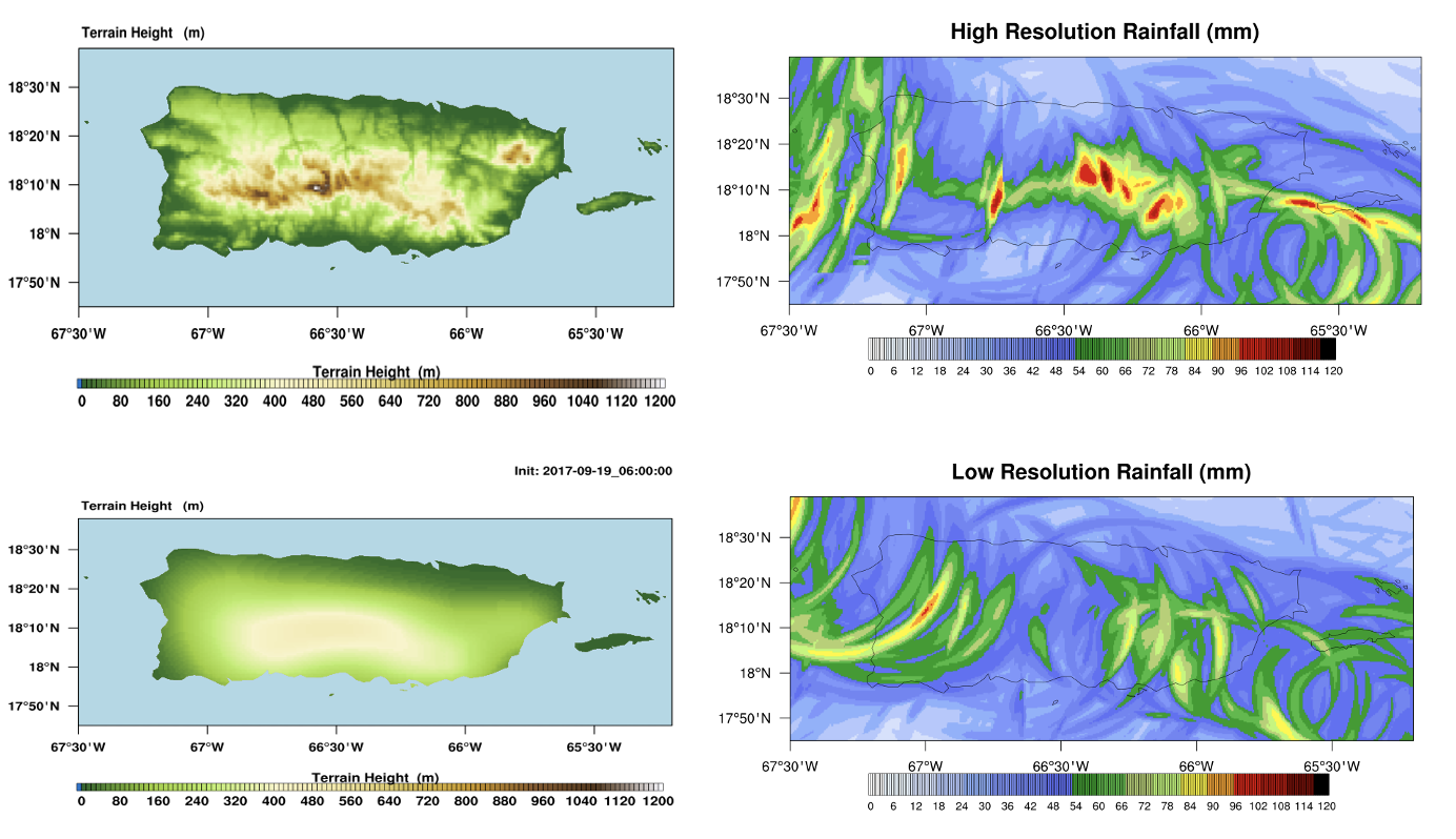
The atmospheric processes involved in a tropical cyclone are affected by topographical factors during and after landfall. Interactions with land can change the tropical cyclone’s structure and behavior and, ultimately, its impact on the landmass. However, one of today’s forecasting challenges is that numerical weather prediction models cannot resolve many factors that influence surface weather, resulting in a forecast that predicts the expected behavior of a tropical cyclone moving over a smooth landmass. Therefore, these models do not accurately represent the impact at landfall of these systems in regions characterized by complex terrain and multiple mountain ranges. This research project investigated how terrain resolution affects the landfall and behavior of tropical cyclones focusing on the landfall of Hurricane Maria in Puerto Rico in 2017.
Main Findings
A set of simulations were produced using the Weather Research and Forecasting (WRF) model, where one used the default terrain resolution and the other used high-resolution terrain data. The wind speed, vertical velocity, and precipitation magnitude were shown to be higher in the island’s mountainous interior when incorporating high-resolution terrain. Manuscript
Presentations
Rivera-Torres, N.G., Judt, F. Effect of High-Resolution Topography in Simulations of Hurricane Maria’s Landfall in Puerto Rico. AMS 100th Annual Meeting. Tropical Meteorology and Tropical Cyclones Symposium. Boston, MA. January 2020. Poster
Rivera-Torres, N.G., Judt, F. A Numerical Study on the Landfall of Hurricane Maria in Puerto Rico. 2019 SOARS Colloquium. National Center for Atmospheric Research, Boulder, CO. August 2019. Oral Presentation